Jennings Field Trip July 23, 2021

Friday, July 23,2021 10:00 AM Jennings Prairie, Leaders:  Dianne and Bob  Machesney

  (C) 412-523-0368

Visit the unique ecosystem at Jennings Prairie.

This is the perfect time to explore the relict prairie. The hot weather brings the stunning Blazing Star and some of the other dazzling summer flowers to peak performance. The goldenrods of fall will begin to show. Don’t miss the spectacular butterflies that grace the prairie with their breathtaking beauty. Flycatchers, vireos, tanagers, Common Yellowthroats and Cedar Waxwings sometimes make an appearance. We may come across a Red Eft, the larval form of a Red-spotted Newt.

Outings are free and open to the public. Bring your friends. Trails are wheelchair accessible.Wear a hat and sunscreen. Bring binoculars, field guides, water and a lunch.

Directions From Pittsburgh: take I-79 North to Exit 99, New Castle/ Butler. Drive east on Route 422 roughly 5.8 miles to the Prospect Exit. Turn left (north) onto Route 528.

Continue on Route 528 for about 7 miles. Meet in the Jennings Environmental Center Parking Lot on the left (west) side of the road.

June, 2021 Field Trips

Saturday, June 5, 2021, 9:00 AM

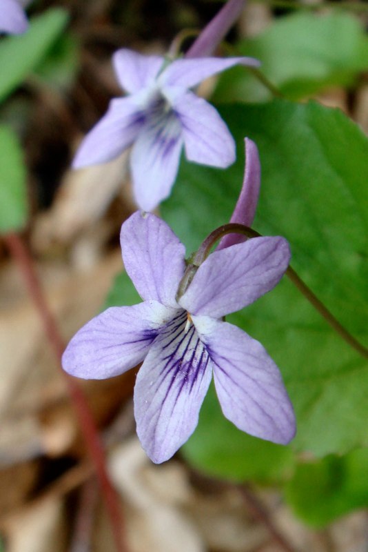
Work Day at Fringed Gentian Fen and Plain Grove Fen Natural Areas, Lawrence County

Western Pennsylvania Conservancy is having a Volunteer Land Steward Work Day at Fringed Gentian Fen Natural Area and Plain Grove Fen Natural Area.  Let’s show our appreciation for the conservation of these areas by joining them for invasive plant removal, woody vegetation control and tree-planting maintenance.

For additional information, go to:  https://waterlandlife.org/volunteer/ , Select “Current Volunteer Opportunities, and the Sat., June 5 event. For questions, contact Andrew Zadnick, Director of Land Stewardship at azadnik@paconserve.org or (412) 977-9681 (cell).

We will meet at 9:00 AM along Frew Mill Road in Shenango Township.

Directions: From Pittsburgh, take I-79 North to Exit 99‑US 422. Turn left onto US 422 west and travel 7 miles. Turn right at PA 388 North and continue 1.2 miles to Frew Mill Road. Turn left onto Frew Mill Road and continue 0.7 mile.

GPS Coordinates: 40.9904, -80.28111

Sunday, June 13, 10:00 AM

South Sandy Creek in State Game Land 39, Venango County

Leader:  Ron Zagrocki; Cell:( 717) 580-5736

Directions: From Pittsburgh, take I-79 north to Exit 121 for US 62 Mercer/Franklin. Turn right and continue 2 miles the point where US 62 turns to the left – but continue straight onto PA 965. Travel PA 965 for 8.5 miles to turn right onto Slatertown Road, a dirt road. Continue  2 1/4 miles to a gravel parking lot on the left. If you drive over an open-grate bridge, you’ve gone too far.

GPS coordinates: 41.29860, -79.94920

Saturday, June 19, 2021, 1:00 PM

Ferncliff Peninsula, Ohiopyle State Park, Fayette County

Leader: Mark Bowers

Contact Information: 4beagles@verizon.net;

cell: (724) 454-4012

Directions:  From Pittsburgh, take the PA Turnpike  to Exit 91 – Donegal. Turn east (left) on PA 31. Travel about 2 miles and turn south (right) on PA 381. Travel ten miles to Normalville to a stop sign.  Turn left onto PA 381 south and continue 11 miles to Ohiopyle. As PA 381 enters Ohiopyle, it crosses railroad tracks. Turn right just before the bridge over the Yough to enter the Ferncliff parking lot, where we will meet. 

Although the state park will be crowded with enthusiastic outdoor recreationists and sightseers, the inland trails will be quiet and ideal for a wildflower hike. We may first head to another hiking trail, so if you arrive late, please call Mark at 724-454-4012 or look for a note directing you to the correct trail.

GPS coordinates: 39.87150, -79.49320

May Field Trips 2021

Saturday, May 15, 2021, 1:00 PM

Boyce Mayview Regional Park, Upper St. Clair Township, Allegheny County

Leader: Mary Ann Pike

Contact Information: cell: (412) 855-8239; mapike@earthlink.net

We will initially travel downhill to get to the riparian forest and wetlands at the bottom. 

Directions: From Pittsburgh, proceed south on US 19 (Washington Road) to Boyce Road which is 3.0 miles south of South Hills Village (at Fort Couch Road). Turn right onto Boyce Road and proceed 0.5 mile to the intersection with Morton Road on the right. Turn right onto Morton Road and continue about 1.5 miles to parking for the Morton Complex on the left side of the road. Park here.

Alternatively, take I-79 south.Take Exit 54/ Bridgeville. At the end of the ramp, turn right onto Millers Run Road (PA 50) and proceed to the traffic light at the T-intersection with Washington Pike. Turn right onto Washington Pike and drive for 2.1 miles to the intersection with Boyce Road. Turn left onto Boyce and proceed 1.4 miles to the traffic light at the intersection with Mayview Road. Continue on Boyce Road for another 1.1 mile to Morton Road. Turn left onto Morton Road and continue about 1.5 miles to parking for the Morton Complex on the left side of the road. Park here. 

GPS Coordinates: 40.32842, -80.09581

Saturday, May 22, 2021, 12:30 PM

Cornplanter State Forest, Strawbridge Tract Crawford County

Leaders:  Joe and Bonnie Isaac; Cell- 724-944-7160; E‑mail:  IsaacB@CarnegieMNH.Org

Start time: 1 p.m. but bring your lunch to enjoy the picnic area at 12:30 pm-ish.

Directions: From Pittsburgh, take I-79 north to Exit 147A for Meadville. Turn right onto US 19. On the highway bridge into town, stay in the right lane to continue straight into town onto Park Ave. Continue 3/4 mile and turn right onto North St for PA 27 East. Continue about ½ mile to pick up a left hand turn onto PA77 East. Continue 12 miles to turn right onto PA 408. Travel PA 408 for 7 miles to Strawbridge Road. Turn left and continue about ½ mile to the parking and picnic area. 

GPS coordinates: 41.6754, -79.8533 Reply  Reply All  Forward

Shollard’s Wetland Field Trip

cattails

Friday, June 28, 2019 at 10:00 am. Leader: Dianne and Bob Machesney

(H) 412-366-7869 (C) 412-523-0368

Directions:
79 North to route 488 exit- Portersville. Left at the exit to rte. 19.Take rte 19 north 13 miles make right on Black Road. Pass the corn silos. At bottom of hill is 4 way intersection. Turn left on Nelson rd .About 1/2 mile turn right onto #2 Mine Rd. Pass swamps on either side of road. At the rise in the road turn right into gravel/grass parking lot, where we will meet. Just past the parking lot is the railroad grade on the left that goes thru Shollards wetland where we will be walking.  The gated road in the parking lot goes back to Black Swamp and many ponds.

Shollards parking lot GPS coordinates:

N41.11441 —W80.19218   Elevation 1233 feet above sea level. 

No facilities here. Pack a lunch and a chair .

Field Trip with Botanical Society of W. PA.

Sunday, March 31, 2019, 1:00 PM

Little Sewickley Creek outside of Herminie. Westmoreland County

This is a favorite trip for early spring ephemerals and Snow Trillium. The walk is easy along an old railroad grade.

Directions: Take the PA Turnpike to Exit 67-Route 30/Irwin/Greensburg. Take the Route 30 East/Greensburg ramp. At the first stoplight on Route 30, turn right onto Arona Road, then another right after 0.5 mile onto unmarked Wendel Road. Travel this road 3.7 miles to a T. Turn right at the T and continue 1 mile to Herminie to a 4-way stop (VFD on corner). Continue straight to the next stop sign and turn left. Proceed through 2 more stop signs, end at a T, and turn right. Continue past the Dairy Queen on your right and continue down a hill; we will meet just before the highway bridge. Park on the left side.

These directions are difficult as roads are unmarked and state roads through Herminie sometimes look like alleys.
If you can use them, the GPS coordinates will likely take you by a more direct route. GPS coordinates: 40.26050, -79.72700.

Directions to Cedar Creek Gorge

Saturday, May 19, 2018, 1:00 PM
Cedar Creek Gorge, Westmoreland County
Leaders: Mark Bowers, cell 724-454-4012; monarda55@gmail.com

Directions: From Pittsburgh, travel PA 51 south to its junction with PA 201 (just after Bills and Willowbrook Plaza). Continuing on PA 51, travel 2 additional miles to the traffic light for Concord Ln (gas station and Burger King on left) and turn left. (This traffic light at Concord Ln can also be reached by I-70 exit 46B and continuing north on PA 51 for a very short distance). Traveling on Concord Ln, bear right at fork and then turn right onto Municipal Dr. Continue about 0.6 mile past Timm’s Lane, and turn left into the main entrance to Cedar Creek Park. Follow this road downhill, cross the bike trail, and turn left to continue through a series of parking lots until you reach the farthest parking lot, near the Gorge Trail.
GPS coordinates: 40.17830, -79.77820
Cedar Creek, known for Snow Trillium in March and Bluebells in April, has many interesting calciphiles in the upper slopes and an explosion of Few-flowered Valerians on the floodplain in mid-May.
Saturday, May 26, 2018, 10:00 AM

Directions to Limestone Rd, SGL 51, Dunbar

Saturday, May 12, 2018, 1:00 PM
Limestone Run, S.G.L. 51 near Dunbar, Fayette County
Leader: Loree Speedy – 724-518-6022 cell; loreespeedy@gmail.com
Directions: Exit the I-76 PA Turnpike at Exit 75 New Stanton and head south on US 119 to Connellsville. Once you cross the bridge over the Yough just before Connellsville, set your mileage. Continue on US 119 south for 3.5 miles to a make a left turn onto Dunbar Rd at the traffic light. Proceed downhill and through the town of Dunbar by following signs to Ohiopyle (right after the RR tracks, left at the stop sign). From the stop sign, proceed 3 miles on the state road (passing a shooting range on the left) to a dirt game land road. The paved road turns to the left, but you will turn rightish onto the dirt game land road, just before a game commission facility. (If you pass the Public Hunting sign, turn around safely). Continue along this road about 1 mile to the parking area at the end.
GPS coordinates: 39.94478, -79.57903 (This is the beginning of dirt game land road. Continue 1 mile to parking area.)

Directions to Wolf Creek Narrows

Monday, May 7, 2018, 10:00 AM
Wolf Creek Narrows, Butler County
Leader: Dianne Machesney; Contact Information: DIANNEM15237@aol.com; cell: (412) 523-0368; home: (412) 366-7869
Directions: From Pittsburgh take I-79 north to Exit 105. At the end of the ramp turn left on PA 108. Travel east on PA 108 for about 0.7 miles to West Park Rd (Dairy Queen on the right). Turn left onto West Park Road (SR 1015) and drive north about 1.8 miles to SR 1020 (you can see some large silos on the right). Turn right on SR 1020 (Miller Rd) and drive about 1.7 miles to the small parking lot on the right. (SR 1020 is a winding road and at an almost T intersection, turn right to stay on SR 1020.) If you reach the bridge, you have gone too far. The parking lot is just before you reach the bridge over Wolf Creek.
GPS coordinates: 41.06370, -80.08820

Directions to Butler- Freeport Trail – Monroe Road

Sunday, May 6, 2018, 1:00 PM
Butler-Freeport Trail, Monroe Road Trailhead, Butler County
Leader: Adam Haritan of LearnYourLand.com
Adam is a wild-food enthusiast, researcher, forager, leader of educational walks, and a blogger on LearnYourLand.com.
Directions: From Pittsburgh: take PA-28 North to Exit 17 (PA-356/Butler/Freeport). At end of ramp, turn right to travel PA-356 for a little less than a mile. At the Sheetz, turn right onto Monroe Road and travel about 0.8 mile and turn left into a driveway for the Buffalo Creek Nature Center, just before the bike trail.
GPS coordinates: 40.70760, -79.71310

Directions to McDanels Boat Launch, Moraine State Park

Saturday, May 5, 2018, 10:00 AM
Wildflower Wanderings at Moraine State Park McDanels Launch Area, Butler County
Leader: Bonnie Isaac; Cell- 724-944-7160; E-mail: IsaacB@CarnegieMNH.Org
Directions: Travel I-79 north to Exit 96/ Portersville. And turn right onto PA 488. Continue 1.2 miles and turn left onto Pleasant Valley Rd at the Moraine State Park Sign. Continue 0.8 miles to US422 west. Continue west on US422 for 2 miles to the North Shore ramp. Keep right to continue on McDanels Rd. Turn right onto McDanels Rd and continue to boat launch. Meet by the North Country Scenic Trail near the purple martin houses along the entrance road.
GPS coordinates: 40.96620, -80.12570
McDanel’s is a popular area, but many people may be overlooking delicate gems of spring in the nearby woods. We will explore the woods along a portion of the North Country National Scenic Trail, hunting for these beautiful flowers of spring.