Trip Report Raccoon Creek Wildflower Preserve April 27 2018

Eight club members hiked the wildflower preserve on a 55 degree cloudy day led by Dianne Machesney.  Judy, Donna, Tim, Charmie,    Bob, Jessica  and Karen saw 36 flowering species. After lunch we went to Independence Marsh and saw 25 species, including Shooting Star.  Only two butterflies were spotted: E. Comma and Spring Azure.  Click here for the list of plants.

Here are some photos from the hike:   (Photos by: Dianne Machesney)

Yellow Corydalis

Wild Ginger

Wild Blue Phlox

Virginia Bluebells

Trout Lily

Squirrel Corn

Virginia Spring Beauties

Shooting Star

Lyre Leaved Rock Cress

Karen and Dianne

Harbinger of Spring

Grandiflora Trillium

Foam Flower

Early Saxifrage

Dwarf Larkspur

Cut leaf Toothwort

Blue Cohosh

Kidney leaved buttercup Photo by: Tim Prepelka

April 12th Meeting

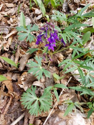
Thursday, April 12, 7:30 pm.

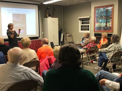
Kirsi Jansa presented How to Face the Challenges Climate Change Presents Us Without Becoming Overwhelmed. Sustainability Pioneers – maker of locally produced short documentaries- showcased individuals, communities and states in the US and in Europe taking bold climate action. Pittsburgh Mayor Peduto was highlighted, as was Frick Environmental Center.   The screening was followed by comments and input from the audience about how climate change affects them personally.

RESOURCES FOR CLIMATE ACTION

Links to the sites Kirsi mentioned: Sustainability Pioneers ​short documentaries free online at ​www.sustainabilitypioneers.com Sustainability Pioneers on Facebook: ​https://www.facebook.com/SustainabilityPioneers/

Gas Rush Stories​ short documentaries free online at​ ​ ​www.gasrushstories.com Gas Rush Stories on Facebook: https://www.facebook.com/Gas-Rush-Stories-217836678335199/

Creatives for Climate collaborative​: ​https://creatives4climate.wordpress.com Creatives for Climate on Facebook: ​https://www.facebook.com/creatives4climate/

Book  ” Active Hope”  by Joanna Macy and Chris Johnstone​ ​https://www.activehope.info

SWITCH TO RENEWABLE ENERGY The official electric shopping website of the Pennsylvania Public Utility Commission (PA PUC)​http://www.papowerswitch.com To make sure you get what you want and won’t run into unexpected price-hikes in the future, here’s guidance by ​PennFuture​. https://www.pennfuture.org/Files/Admin/TakethePowerBack%5FSteps%2Dto%2DTake%2Dfor%2D Parents.pdf

Earth Day at the Frick Environmental Center https://www.facebook.com/events/1823146207989568/?event_time_id=1823146211322901

Make your climate promise DearTomorrow​ ​https://www.deartomorrow.org/en/home/

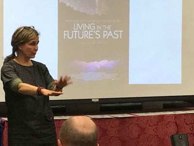
New documentary with Jeff Bridges Living in the Future’s Past – TRAILER​ ​https://vimeo.com/243404072 Official site ​https://www.livinginthefuturespastfilm.com

Directions to Cedar Creek Gorge

Saturday, May 19, 2018, 1:00 PM
Cedar Creek Gorge, Westmoreland County
Leaders: Mark Bowers, cell 724-454-4012; monarda55@gmail.com

Directions: From Pittsburgh, travel PA 51 south to its junction with PA 201 (just after Bills and Willowbrook Plaza). Continuing on PA 51, travel 2 additional miles to the traffic light for Concord Ln (gas station and Burger King on left) and turn left. (This traffic light at Concord Ln can also be reached by I-70 exit 46B and continuing north on PA 51 for a very short distance). Traveling on Concord Ln, bear right at fork and then turn right onto Municipal Dr. Continue about 0.6 mile past Timm’s Lane, and turn left into the main entrance to Cedar Creek Park. Follow this road downhill, cross the bike trail, and turn left to continue through a series of parking lots until you reach the farthest parking lot, near the Gorge Trail.
GPS coordinates: 40.17830, -79.77820
Cedar Creek, known for Snow Trillium in March and Bluebells in April, has many interesting calciphiles in the upper slopes and an explosion of Few-flowered Valerians on the floodplain in mid-May.
Saturday, May 26, 2018, 10:00 AM

Directions to Limestone Rd, SGL 51, Dunbar

Saturday, May 12, 2018, 1:00 PM
Limestone Run, S.G.L. 51 near Dunbar, Fayette County
Leader: Loree Speedy – 724-518-6022 cell; loreespeedy@gmail.com
Directions: Exit the I-76 PA Turnpike at Exit 75 New Stanton and head south on US 119 to Connellsville. Once you cross the bridge over the Yough just before Connellsville, set your mileage. Continue on US 119 south for 3.5 miles to a make a left turn onto Dunbar Rd at the traffic light. Proceed downhill and through the town of Dunbar by following signs to Ohiopyle (right after the RR tracks, left at the stop sign). From the stop sign, proceed 3 miles on the state road (passing a shooting range on the left) to a dirt game land road. The paved road turns to the left, but you will turn rightish onto the dirt game land road, just before a game commission facility. (If you pass the Public Hunting sign, turn around safely). Continue along this road about 1 mile to the parking area at the end.
GPS coordinates: 39.94478, -79.57903 (This is the beginning of dirt game land road. Continue 1 mile to parking area.)

Directions to Wolf Creek Narrows

Monday, May 7, 2018, 10:00 AM
Wolf Creek Narrows, Butler County
Leader: Dianne Machesney; Contact Information: DIANNEM15237@aol.com; cell: (412) 523-0368; home: (412) 366-7869
Directions: From Pittsburgh take I-79 north to Exit 105. At the end of the ramp turn left on PA 108. Travel east on PA 108 for about 0.7 miles to West Park Rd (Dairy Queen on the right). Turn left onto West Park Road (SR 1015) and drive north about 1.8 miles to SR 1020 (you can see some large silos on the right). Turn right on SR 1020 (Miller Rd) and drive about 1.7 miles to the small parking lot on the right. (SR 1020 is a winding road and at an almost T intersection, turn right to stay on SR 1020.) If you reach the bridge, you have gone too far. The parking lot is just before you reach the bridge over Wolf Creek.
GPS coordinates: 41.06370, -80.08820

Directions to Butler- Freeport Trail – Monroe Road

Sunday, May 6, 2018, 1:00 PM
Butler-Freeport Trail, Monroe Road Trailhead, Butler County
Leader: Adam Haritan of LearnYourLand.com
Adam is a wild-food enthusiast, researcher, forager, leader of educational walks, and a blogger on LearnYourLand.com.
Directions: From Pittsburgh: take PA-28 North to Exit 17 (PA-356/Butler/Freeport). At end of ramp, turn right to travel PA-356 for a little less than a mile. At the Sheetz, turn right onto Monroe Road and travel about 0.8 mile and turn left into a driveway for the Buffalo Creek Nature Center, just before the bike trail.
GPS coordinates: 40.70760, -79.71310

Directions to McDanels Boat Launch, Moraine State Park

Saturday, May 5, 2018, 10:00 AM
Wildflower Wanderings at Moraine State Park McDanels Launch Area, Butler County
Leader: Bonnie Isaac; Cell- 724-944-7160; E-mail: IsaacB@CarnegieMNH.Org
Directions: Travel I-79 north to Exit 96/ Portersville. And turn right onto PA 488. Continue 1.2 miles and turn left onto Pleasant Valley Rd at the Moraine State Park Sign. Continue 0.8 miles to US422 west. Continue west on US422 for 2 miles to the North Shore ramp. Keep right to continue on McDanels Rd. Turn right onto McDanels Rd and continue to boat launch. Meet by the North Country Scenic Trail near the purple martin houses along the entrance road.
GPS coordinates: 40.96620, -80.12570
McDanel’s is a popular area, but many people may be overlooking delicate gems of spring in the nearby woods. We will explore the woods along a portion of the North Country National Scenic Trail, hunting for these beautiful flowers of spring.

Directions to Enlow Fork Natural Area

Sunday, April 29, 2018, All Day!
Enlow Fork Natural Area, Greene County
Time: Nature events all day; 10 a.m. for the wildflower walk; come early for the 8 a.m spring migrant walk
Event Organizer: Larry Helgerman, bobolink1989@gmail.com
Directions: There are many ways to get to the EFNA; if you have never been there use the GPS coordinates 39.961076, -80.462700 with Google maps ahead of time! EFNA is located at the end of Smokey Row Rd. in PA State Game Lands 302. Signs will be posted close to the event location.
In between the main walks there will be tents set up with information on birding, wildflowers, nature, and watersheds. Food will be available for sale. Bring a chair and enjoy the day.

Directions to Friendship Hill National Historic Site

Saturday, April 28, 2018, 10:30 AM
Friendship Hill National Historic Site, Fayette County
Directions: From Pittsburgh, travel I-79 south to the Exit 14-Waynesburg. Turn left onto PA 21 east. Travel PA 21 east for 14.5 miles to PA 166 south toward Masontown. Travel PA 166 south for 17 miles to the entrance for the Friendship Hill National Historic Site on the left (this is shortly after Gallatin schools outside of New Geneva). Turn right and continue to the Gallatin House Parking Lot where we will meet.
GPS coordinates: 39.77130, -79.92380
We will meet the Westmoreland Bird and Nature Club for a walk through Sophie’s Woods, an old-growth woods along the slopes of the Monongahela River.

Directions to Raccoon Creek Wildflower Reserve

Friday, April 27, 2018, 10:00 AM
Raccoon Creek Wildflower Reserve, Beaver County
Leader: Dianne Machesney, DIANNEM15237@aol.com; cell: (412) 523-0368; home: (412) 366-7869
Directions: From Pittsburgh, take the Parkway West – Route 376 west (former Route 60 north) to Exit 52, Clinton (one exit past the Airport). At the end of the ramp, turn left and continue 1.1 miles to US 30. Turn right onto US 30 and drive 4.7 miles to the entrance for the Wildflower Reserve, on the right, just over a hill.
GPS coordinates: 40.50700, -80.36490
The Wildflower Reserve has one of the most diverse populations of plants in the state. Be prepared for wet trails and moderate hiking.